
1. Documentation
The third semester of the master program “Physical Geography: Environmental History” at the University of Bremen provides the students with the possibility to collect abroad experiences. Along these lines, I absolved a scientific internship at the Institut de Ciències de la Terra Jaume Almera (ICTJA – Institute of Earth Sciences Jaume Almera) in Barcelona.
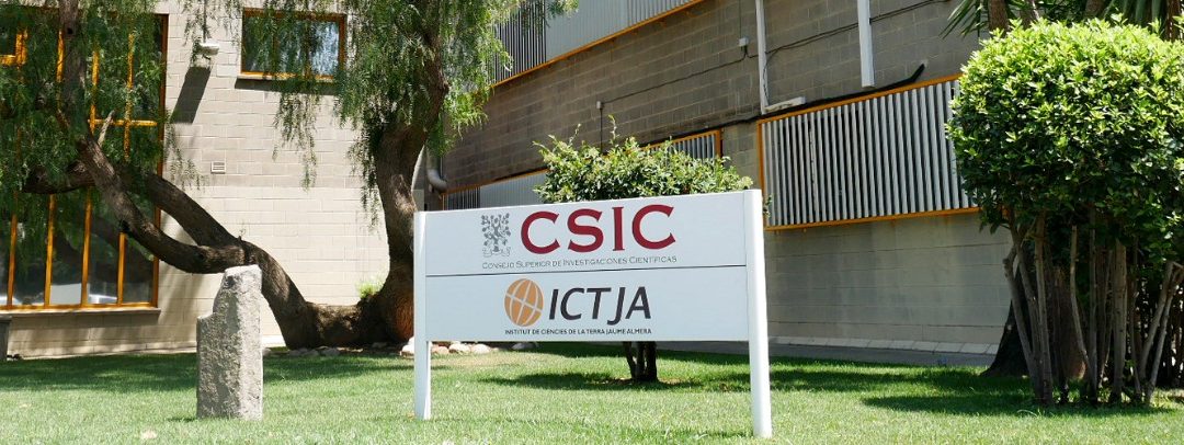
a. The institution
In 1965, the Spanish Consejo Superior de Investigaciones Cientificas (CSIC – Spanish National Research Council) reorganized itself and created under direction of Dr. Lluis Solé Sabarís the ICTJA (previously IJAIG – Instituto Jaume Almera de Investigaciones Geológicas). It was named after the Catalan geoscientist, paleontologist and theologist Jaume Almera I Comas (1845-1919), who studied and worked at the University of Barcelona. The institute started with the purpose to investigate the geology of Barcelona and surrounding areas. After several restructures, the institute consists today of two departments: “Structure and Dynamics of the Earth and Crystallography” and “Environmental Geology and Geohazards” [1]. Both departments concentrate still on the investigation of the surrounding areas of Barcelona, but also expand their research to projects all over the world and thus developed to an international research institution.
My application was directed towards Santiago Giralt Romeu, a researcher with geoscientific background, working at the second mentioned department in the group “Environmental Changes in the Geological Record” which is leaded by Jose-Luis Fernandez-Turiel. Combining the investigation of lacustrine sedimentology with geochemical, biological and physical proxy studies, the group reconstructs climate and environmental fluctuations and variabilities and identify trends of changing behavior in short and long time scales and thus provides new insights into earth’s history and anthropogenic development [2].
The group has four ongoing projects and as principle investigator of the project “Holocene climate and ecological impacts of the East Atlantic pattern (EA) and North Atlantic Oscillation (NAO) interplay in southwestern Atlantic Europe” (PaleoModes) Santiago Giralt Romeu invited me to work with him and his team on that and offered me several options to focus on.
Since lacustrine records are sensible for climatic changes, covering much longer timespans than instrumental measurements exists, the project use them to improve the knowledge about changes in special and temporal patterns of modes over the Atlantic.
Previous work of the group investigated several lakes and weather records of the Iberian Peninsula [3] and the Azores Archipelago [4-7], whereas papers dealing with the latter, only implicate exploration of the central and eastern islands. At the time of application, new sediment cores from the western islands of the Archipelago Corvo and Flores were obtained, what made it possible for me to be part of investigation from the beginning.
Before the internship started, we decided that it will imply an environmental reconstruction of Corvo and Flores island, using the inorganic and organic characteristics of their lacustrine sediments and further through statistical treatment of the obtained datasets.
b. Tasks and responsibilities
The internship started approximately a half year after the fieldtrip to the islands Corvo and Funda, where lacustrine sediment cores of (among others) Lake Calderão and Lake Funda were obtained. At the time of arrival at the institute, these cores were already opened and the description of the lithology was done. During the internship, I was involved and responsible for all following steps of analyzing these cores relating to physical and chemical investigations. The tasks can be distinguished in three parts: 1. laboratory work, 2. computer-based analysis and 3. the interpretation.
In the first week, I was introduced to the AVAATECH XRF II core scanner at the University of Barcelona, which is located very close to the institute. There the X-ray fluorescence (XRF) was measured, which included previous preparation of all cores and preparation of the dataset after measurement. After a few days of assisting this process, I was responsible to finishing all measurements on my own. Since there were 13 cores and as one measurement took about a half a day, this work was finished during the following two weeks.
As soon as one core was finished XRF, it was possible to start sampling. The sample density was 1 cm sample each 5 cm. All in all, I finished 300 samples, 114 for Lake Funda and 186 for Lake Calderao. These samples had to dry 48 hours in the oven at 60°C, to be subsequently prepared for the X-ray diffraction (XRD) measurement. The measurement was done using a SIEMENS-D500 automatic X-ray diffractometer at the ICTJA. The preparation included the fine grounding with a mortar of the samples and the movement to special tubes of the XRD. For this, the fine minerals of the grounded samples had to be orientated in a plane surface through a twisting movement during the preparation.
The created dataset had to be interpreted afterwards, which was done with the software EVA. This work included the search and identifying of peaks, which enabled a detailed idea of the inorganic, mineralogical composition of the sediments. As not every sample gave a clear signal, it was necessary to have a further look on a few samples with the Electron Microscope (EM). This gave me the opportunity to have a look on this process, as far as I assisted while Santiago Giralt and a geochemistry expert from the University of Barcelona had a look on the samples.
To analyze the remaining organic part of the sediments, the samples were measured with an element analyzer, exteriorly of the institute. My part was to prepare the samples for this measurement, weighing 10 mg for Funda and 5 mg for Calderão in tin-capsules. One week after this, the results were available and gave information about the Total Organic Carbon (TOC), Total Nitrogen (TN) and their isotopic ratios δ13C and δ15N.
In the 8th week, the dataset was completed finishing an Excel-sheet containing all data collected before. This was necessary to provide the data to the group on the one hand and to start with the statistical treatment on the other hand. After I got an introduction into the R software [8] and the packages that the group use for statistical approach and visualization of data, it was up to me to apply this on the finished dataset and to write a code to create some figures of multivariate statistics.
The last weeks were used for interpretation of the obtained datasets and statistics. Responsively I was either discussing with people of the group about the results, or I tried to write some first conclusions down. This went hand in hand with reading other scientific papers of the group and other scientists dealing with the topic.
Further, I got the time to create maps with QGIS (free software, similar to ArcGIS) and enhanced the R graphics and diagrams with CorelDraw. Additionally I got to know Latex, which was new for me in comparison to the other software.
2. Reflection
Overall, the internship was very successful and I experienced a great time during the work and with the people of it. The institute gave me an insight into research life, including advantages as well as disadvantages.
The institute and the project that I was involved in, turned out to be a perfect place for me, based on the experience and knowledge I brought along and the work that I done. I was familiar with working on lacustrine archives due to my current master program and my bachelor’s degree in geoscience was an appropriate supplement for this, not at least because my supervisor has also a geoscientific background. However, working with lacustrine records means a multidisciplinary way of working, requiring knowledge from many different disciplines, what makes it a rather complex field. I realized that it takes more time to get a stable overview of all biological, physical, chemical and sedimentary processes that are triggered by environmental forcing and that I already have a good basis with geoscientific related topics, e.g. volcanology, mineralogy and partly geochemistry.
I was also able to adapt my background knowledge during the laboratory and the computer based part of the internship. With most of the techniques that I performed in the laboratory, I was already aware, having had a good introductory lecture in the master program. Additional techniques were the XRD-analysis and the view on minerals with an electronic microscope, but also those were parts of my previous geoscientific study and thus had to be refreshed. The same hold true for the subsequent work at the computer, using software or very similar software like QGIS, R or CorelDraw.
However, there were also some new aspects. During the interpretation work, I noticed that I was not completely confident with climatological processes, thus it was necessary to read some lecture about it. At this point, I realized that my interest for this started to grow the more that I read. I should mention here, that I had the possibility in my master program to focus on this, but at the point of decision, I chose some different modules, not dealing with climatology.
A complete new possibility opened at that point, that I was not thinking about before. My plan is now to catch up on knowledge about climatology, climate change and especially climate modeling, to get a better opinion if I want to continue to work with it in my later jobs or not. After some conversations with different people from the institute, I realized that it is a very important field and from great interest for many research projects, especially in combination with lacustrine archives. Further, they told me that they themselves have interest in hiring a PhD-student who works for the project and concentrates on climate modelling based on the lacustrine sediments they are currently working with. I could imagine applying on the institute after I finished my study.
In contrast, I can say now, that I don’t want to continue to focus on Archaeobotany. I was in good contact to the experts of the institute dealing with pollen, and I confirmed my opinion, which I got during the master programs lecture, that it would be an advantage if you have a botanical or ecological background. Moreover, counting pollen requires partly months of working at the microscope, which seems not attractive for myself.
I had two reasons to complete an internship instead of, as we had the possibility, to take some lectures abroad, and in hindsight, both were fulfilled. The first aim was to get more practice in the laboratory work. As more a third of my internship took place in the laboratory, I can say now, that I feel like I can adapt this knowledge to possible future workplaces.
The second aim was to get to know the research world. It was a great experience for me to be surrounded every day by PhD-students and researchers of many different fields. It was a motivating environment and my interest in continuing with research and doing a doctorate in the next step is reinforced. But, and this is the point that busied me most during the internship and this is also the reason why I want to mention this here, is that it still seems to be hard for women in science. I had some very interesting conversations with the female colleagues and they all agreed with the opinion, that there is a big gap between women and men in research. To sum up these conversations, it seems like you have to decide as a women between research career and family planning, because both would not work very well together. For sure, there might be a difference between Spain and Germany, but the research business is an international one and so we are also affected by this.
However, as this was a shocking aspect for me and at some point a little demotivating, I think, that this point is argued a lot in these days and that it will get easier in the upcoming years. Today there are several fellowships supporting especially women in science (https://www.scholarshipsforwomen.net/science/) and it seems like that there are ways to combine research and family. For me, it was important to be confronted with this aspect, because in this way I got the possibility to think and inform myself about it very early.
1. ICTJA (2018), History. Available from: http://www.ictja.csic.es/index.php/about-ictja/history. (Last access: 13.04.18)
2. ICTJA (2018), Environmental Changes in the Geological Record. Available from: http://www.ictja.csic.es/index.php/research/research-groups/environmental-changes-in-the-geological-record. (Last access: 13.04.18)
3. Sánchez-López, G, et al. (2016), Climate reconstruction for the last two millennia in central Iberia: The role of East Atlantic (EA), North Atlantic Oscillation (NAO) and their interplay over the Iberian Peninsula. Quaternary science reviews. 149: p. 135-150.
4. Hernández, Armand, et al. (2014), A multiproxy reconstruction of NAO evolution in the Azores archipelago since 1350 AD. in EGU General Assembly Conference Abstracts.
5. Hernández, Armand, et al. (2016), New Azores archipelago daily precipitation dataset and its links with large‐scale modes of climate variability. International Journal of Climatology. 36 (14): p. 4439-4454.
6. Hernández, Armand, et al. (2017), The influences of the AMO and NAO on the sedimentary infill in an Azores Archipelago lake since ca. 1350 CE. Global and Planetary Change. 154: p. 61-74.
7. Hernández, Armand, et al. (2015), Exploring the new long-term (150 years) precipitation dataset in Azores archipelago. in EGU General Assembly Conference Abstracts.
8. R-Team (2018), R: A Language and Environment for Statistical Computing. Available from: http://www.R-project.org/. (Last access: 13.04.18)
Neueste Kommentare